Falklands, Freshwater Project for the Islands community, farming and MPC
Collecting data from a stream on Fitzroy Farm
A Freshwater Project for the Falkland Islands funded by UK’s Darwin Plus program plus Falklands’ Government and led by SAERI, South Atlantic Environmental Research Institute in partnership with UK’s Centre for Ecology & Hydrology (UKCEH) has been working intensely in the terrestrial ecosystems of the archipelago, given its sensitivity in land use and climate change.
This 2-year project recognizes these challenges, and given farming is the very fabric of the FI community, a growing desire exists for data driven solutions to facilitate innovation and sustainable land management and climate change adaptation. This means bringing together existing data and data tools plus harnessing technological solutions.
The high-level research aims are to: a) Use freely available Landsat and Sentinel satellite imagery to assess past (last 30 y) and present freshwater dynamics (surface water extent and soil moisture (e.g. Normalized Difference Moisture Index, Soil Water Index), and b) Model future scenarios of freshwater dynamics using a number of data-driven gridded models.
According to a SAERI report, freshwater is essential to life in the Falkland Islands, supporting farming, wildlife, and the wider environment. In recent years, however, many local communities have noticed ongoing drying and are increasingly concerned about changes in freshwater availability.
The Freshwater Project was established to investigate these changes by combining farmers’ on the ground knowledge with satellite-derived data. The aim is to better understand how ponds, streams, and wetlands across the Islands are changing, and how they can be managed more effectively in the future.
During Farmers Week 2025, twelve farmers shared their experiences through a short survey. Based on their responses, together with our satellite observations, we produced a new report that tracks freshwater changes across the Islands. This report brings together local knowledge and satellite data to provide a clearer picture of how ponds, streams, and wetlands are changing. We also shared this new study report and an infographic with farmers summarizing the key findings.
As part of the continued effort to strengthen hydrological monitoring across the Falkland Islands, the team carried out routine field checks to confirm the operational status of all deployed Baro Stout and Level Stout water-level loggers. Site visits included: Big Pond, Bleaker Island – 30 October to 1 November 2025 and Tern Hill Stream, Weddell Island – 13 November 2025.
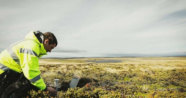
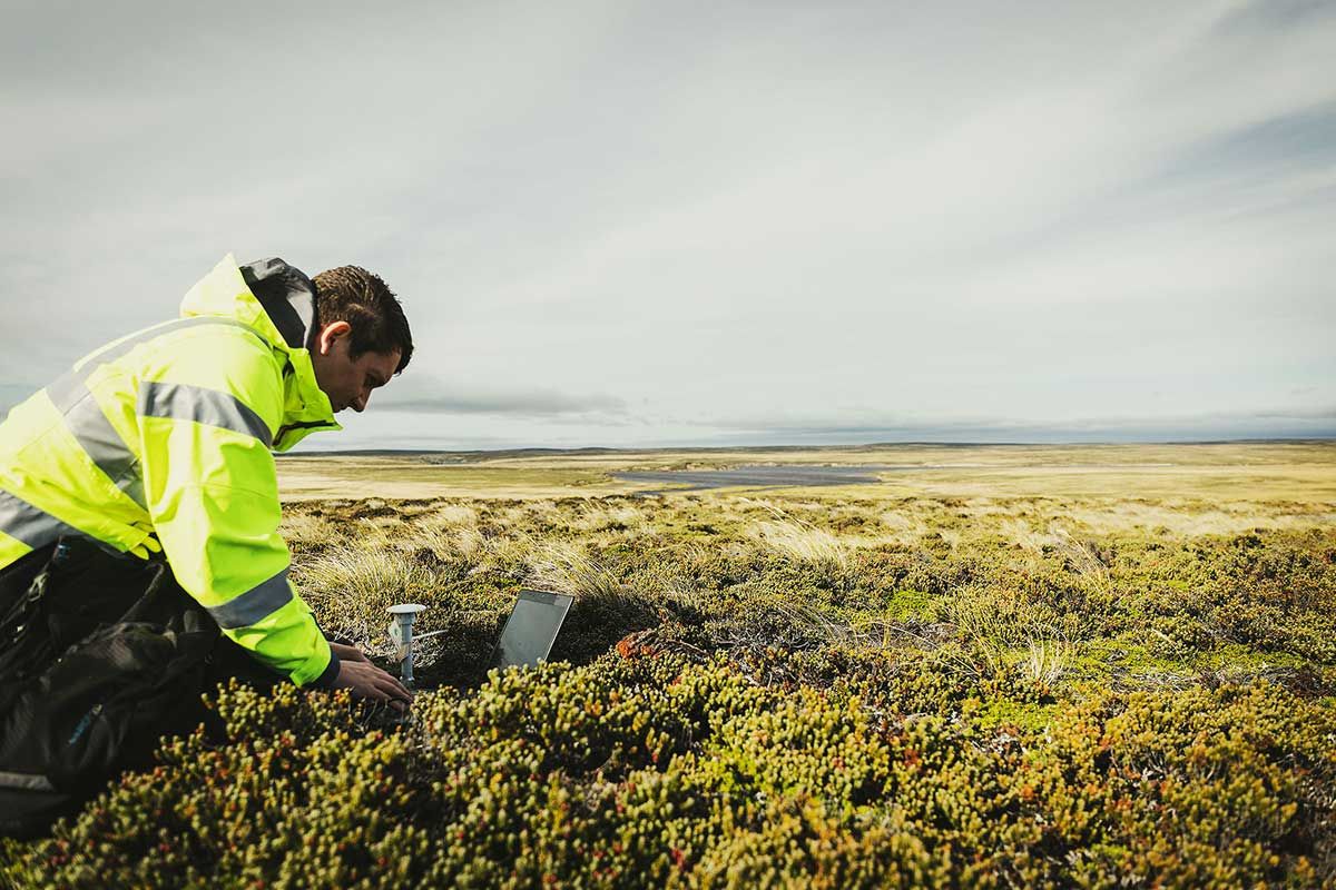
Likewise the project also focused on supporting satellite-based research and hydrological modelling through in-situ measurements from TMS data-loggers. Between 13 and 18 November, data from 20 TMS units across Weddell Island were downloaded. These ground-based observations are crucial for calibrating and validating soil moisture indices derived from Sentinel-1 and Sentinel-2 imagery, helping to improve assessments of freshwater dynamics and future climate scenarios.
Testing water supply resilience at MPC. In December 2025, SAERI also volunteered with the MOD Water Supply Assessment Project, assisting the UKCEH team with water-quality and flow measurements at a stream on Fitzroy Farm, just outside MPC below the sewage treatment site.
Experts are trialing Falkland Islands native plants — Milfoil and California Clubrush — to see how effectively they can absorb nutrients and naturally clean grey water.
If successful, these experiments will help shape the future design of wetlands on the Islands and strengthen water resilience at MPC.
“A brilliant example of science, sustainability, and partnership in action,” said MPC sources.