In 2019, the National Institute of Standards and Technology quietly launched a program with the ambitious goal of capturing moonlight, or at least precisely measuring it. The project was a joint venture with NASA, the National Oceanic and Atmospheric Administration, the U.S. Geological Survey, the University of Maryland Baltimore County and Ontario’s McMaster University. Its purpose was to capture and catalog the moon’s reflected light with unparalleled precision so that satellites orbiting Earth could use it as a new universal calibration standard.
To gather the data, NIST researchers deployed an array of state-of-the-art instruments at observatories in Arizona and Hawaii, measuring the moon’s reflected sunlight across multiple wavelengths. These instruments were sensitive enough to capture subtle differences in brightness as the moon cycled through its phases.
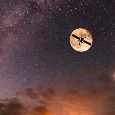
But the land-based telescopes and instruments could only do so much. Their accuracy was limited by the fact that Earth’s atmosphere sometimes blocks accurate readings. Things like cloud cover or light pollution can skew measurements. To compensate, NIST put a special telescope onboard one of NASA’s ER-2 Near-Space airplanes as part of the Airborne Lunar Spectral Irradiance — or air-LUSI — mission. Those aircraft can fly as high as 70,000 feet, which is just over 13 miles above sea level. That puts it above about 95% of the atmosphere, and most of the negative factors that can skew measurements.
The first air-LUSI flight took off in 2022 from NASA’s Armstrong Flight Research Center, with subsequent flights fine-tuning their results and taking follow-up measurements into the early months of this year.
Now, six years after the project started, NIST is releasing the first set of what it’s calling the Moonlight Radiometric Reference Dataset, a trove of data so precise that it could change the way we see our own planet. In the short term, it will allow satellites to be calibrated much more accurately. Satellite operators can now compare what their onboard sensors are reading with a “cosmic calibration lamp” at any point during their missions.
“Our goal with this data release is to help the satellite industry develop better models of lunar irradiance,” said Joe Rice, the NIST group leader for the project. “Using the data will help ensure that scientists have a more accurate understanding of what images of Earth from orbit actually mean.”
The real value of moonlight is that it’s constant, which in space or while in orbit around Earth, is incredibly valuable. Right now, most satellites rely on three different methods in order to maintain the accuracy of their sensors, but none of them are perfect.
Most satellites have on-board calibration devices that can be used to check the accuracy of their sensors. However, both the sensors and the calibration devices themselves tend to lose accuracy over time, and tiny errors can eventually grow to become much bigger problems.
Some satellites are also programmed to take spot measurements using landmarks on Earth, such as large deserts or tall mountains. However, these spots are not truly constant and can change based on snowfall, dust storms, vegetation growth and other factors, or they might be hard to see at times because of cloud cover or other atmospheric anomalies.
Finally, satellite operators with a lot of objects in orbit can cross check their results across the entire system. However, that depends on at least some of the satellites in the constellation operating perfectly without drift or errors. Otherwise, those errors are simply passed on to other satellites as well.
By contrast, the moon is largely unchanging. And the new set of NIST data measures light in different wavelengths, so satellite operators can adjust their sensors more precisely using the complete spectrum.
“This dataset is 10 times more accurate than the data people previously had to use,” said NIST physicist John Woodward. “It will permit a distinct improvement over the other ways we have calibrated satellites.”
This is not the first time that the more static nature of the moon has been tapped for government missions. Last year, NASA began working on the creation of a universal moon time, which could eventually be used to calibrate GPS devices for use with deep-space travel.
The new set of moonlight data will immediately help calibrate the satellites of the government agencies that were involved in the project, namely NASA, NOAA and USGS. But the data is also available through GitHub for anyone to use, so commercial satellite companies will likely not be far behind.
According to agency officials, the moonlight measurement project fits squarely into NIST’s long-standing mission to provide foundational standards for the nation’s science and technology efforts. Just as NIST maintains time standards and defines measurement units, it is now extending its expertise into the realm of space-based observation. The moonlight dataset isn’t just about satellites; it’s about creating a framework where any organization — be it government, academic, or private — can trust the measurements they’re making.
And the timing couldn’t be better. As more agencies rely on satellite data to track greenhouse gases, predict hurricanes or assess wildfire damage, the stakes for accurate measurements have never been higher. A small error in calibration could lead to major misinterpretations, affecting everything from disaster response planning to climate policy. The new dataset should help to prevent even small calibration errors from sneaking into satellite measurements and help them to not drift away from their optimal settings over time.
“Satellites are expensive national assets, and you want them to be as useful as possible,” Woodward said. “If we calibrate them using the moon, satellite observations could become more valuable. For example, we’d know whether the color of farmland had changed because rain had improved crop health, rather than because two different satellites took two different images at different times.”
Looking ahead, NIST plans to expand the moonlight dataset with more frequent measurements, eventually accounting for subtle changes in lunar brightness caused by solar activity or other space weather events. These updates will help satellite operators fine-tune their instruments in real time, improving the long-term continuity of climate and Earth science records.
The moonlight data project might not capture headlines like the latest Mars rover, but its impact could be profound. By using the moon’s steady glow as a guiding light, NIST is making sure that the satellites we rely on can see our planet more clearly than ever before. And in an era when we depend on data from orbit to understand nearly everything about Earth’s changing systems, that’s a kind of moonshot worth celebrating.
John Breeden II is an award-winning journalist and reviewer with over 20 years of experience covering technology. He is the CEO of the Tech Writers Bureau, a group that creates technological thought leadership content for organizations of all sizes. Twitter: @LabGuys