
For the original article by Felipe Lucena published in Diário do Rio, click here.
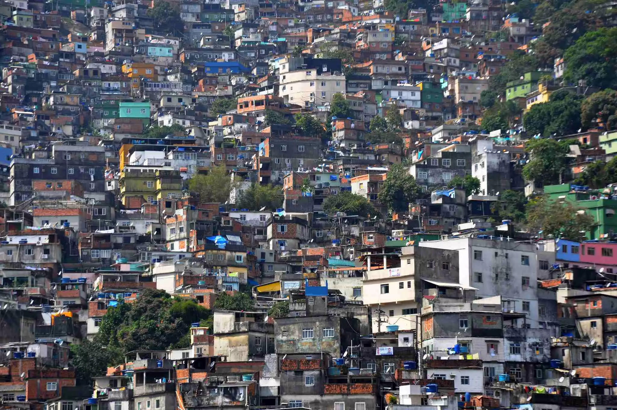
Morro dos Prazeres and Rocinha are among the areas identified in a study developed by Ambiental Media in partnership with the RioNowcast+Green research group, based at the Fluminense Federal University’s (UFF) Computer Science Institute.
The new Extreme Rainfall Vulnerability Index for the city of Rio de Janeiro (IVCE-RJ) shows that 599,000 private homes (21% of all households) are at high risk of landslides or flooding. Of these, 142,000 are at very high risk. Like heatwaves, extreme rainfall events are becoming more intense and frequent due to the effects of global warming—turning Rio de Janeiro into a potential climate time bomb. Explore the Rio 60ºC project website here.
For landslides, 70,000 homes are considered highly vulnerable, with 9,700 at very high risk. For flooding, 530,000 homes are at high risk, including 132,000 at very high risk. The index, which combines geological risk data and socioeconomic indicators, is part of the Rio 60ºC project. Developed by the Ambiental Media team in partnership with the RioNowcast+Green research group at the Fluminense Federal University’s Computer Science Institute, the project focuses on how the city can prepare for extreme climate events.
“Monitoring climate data is part of Ambiental Media’s work, and the rise in extreme weather events is something that concerns us. Even before the tragedy in the state of Rio Grande do Sul, we had already started reflecting on the effects of such devastating rains on a Brazilian capital, after analyzing rainfall data from São Sebastião, in the state of São Paulo, and, a few years earlier, from Petrópolis, in the state of Rio de Janeiro,” explains Thiago Medaglia, executive director of Ambiental Media and one of the creators of the Rio 60ºC project, alongside researcher Mariza Ferro from the RioNowcast+Green group at the Fluminense Federal University (UFF).
Mapping Vulnerabilities

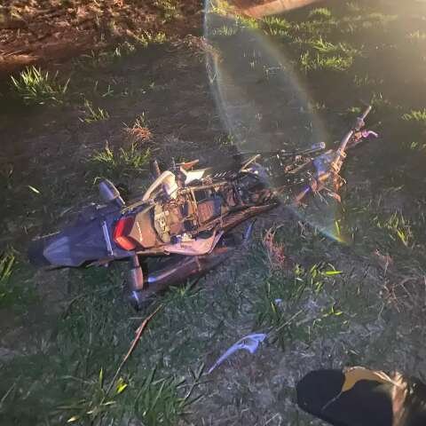
In the Morro dos Prazeres favela in Santa Teresa, where 34 people died in the city’s last major landslide disaster in 2010, the IVCF-RJ shows that 604 private homes (35% of all households) are located in areas of high landslide vulnerability, with 222 classified as very high. In the South Zone, the Pavão-Pavãozinho/Cantagalo favela complex has 3,000 homes (62%) at high risk, with 899 at very high risk. In Rocinha (Rio’s largest favela), 10,500 homes (42%) face high landslide vulnerability, of which 1,400 are at very high risk.

Flood vulnerability is also alarming. In January 2024, heavy rains caused the deaths of four people and damaged over 20,000 homes in the North Zone neighborhoods of Acari, Pavuna, and Irajá. In these three areas, the IVCF-RJ shows that 31,000 homes (34%) are at high flood risk, including 7,600 at very high risk. In Jardim Maravilha, a housing development in Guaratiba, in the city’s West Zone, 7,300 homes (61%) are at high risk, with 2,500 facing very high flood vulnerability. In the Rio das Pedras favela, in Jacarepaguá, 5,100 homes (16%) are in areas of high flood risk, 2,200 of which are considered very high.
Study Methodology and Impact
To map the households most vulnerable to extreme rainfall, the IVCE-RJ cross-referenced socioeconomic data with geological risk information. The analyses drew on the Susceptibility Maps for Gravitational Mass Movements and Floods, produced by the Brazilian Geological Survey (SGB), which define areas as having high, medium, or low susceptibility to floods or mass movements—including landslides, mudflows, and debris flows. The socioeconomic data came from the Pereira Passos Institute’s (IPP) Data.rio portal [the IPP is City Hall’s urban planning agency] and the Brazilian Institute of Geography and Statistics (IBGE, Brazil’s census bureau).
The index is a tool designed to underscore the growing risk of disasters and to support actions toward adaptation and climate justice. In addition to the IVCE-RJ, the Rio 60ºC project brings together investigative journalism and climate modeling to offer special reports, infographics, and interactive maps, allowing for an analysis of the city’s most critical areas. “The index was created to contribute to the climate debate, with a particular focus on Brazil’s capital cities,” explains Thiago Medaglia, executive director of Ambiental Media. “However, it is important to consider that while the IVCE-RJ is grounded in cutting-edge science and was co-created by scientists and journalists, it is a scientific communication tool based on publicly available data rather than on conventional academic research,” he adds.
Adaptation Measures
If the urban landscape—with its gray buildings and paved surfaces—did not exist, rainwater would flow down the hills and be absorbed by the soil, lagoons, and mangroves, eventually reaching the sea through rivers and other natural waterways. But the asphalt laid down by disorderly growth and unplanned urbanization makes the ground impermeable, preventing the natural flow of water. The result: flooded streets and homes.
The city needs urban restructuring that integrates Nature-based Solutions (NbS), such as floodable parks, levees, and effective drainage systems. Without these, lives will be at risk with every new storm. It is also urgent to ensure that the population can protect itself.
As part of the Rio 60ºC project, Ambiental Media released a list of 10 key measures to help prevent tragedies caused by extreme rainfall. The infographic brings together essential actions such as setting up support centers, planting trees, improving water drainage, cleaning rivers, and installing weather stations and rain gauges, among others.
Sirens, one of the city’s most essential tools, are also one of its weak spots. In 2011, 168 sirens were installed through the Cariocas Sirens program. Today 164 are operational—covering just one-third of the city’s potential risk areas.
The current scenario demands urgency. “We hope the data will help direct attention and investments toward climate adaptation in the urban peripheries, and improve the collection and availability of reliable data for both the general population and researchers,” says Mariza Ferro, coordinator of RioNowcast+Green.
The Rio 60ºC project is supported by the Pulitzer Center and the Serrapilheira Institute. “After an event that brought together scientists and journalists, I began working in partnership with Mariza Ferro, from IC/UFF. At first, the project was going to be called ‘Rio 40ºC’ (104ºF)—a musical reference [to Fernanda Abreu’s 1992 song]—but we soon realized the reality was even more alarming: Rio’s heat index had already surpassed 60ºC (140ºF). The city is on the brink of climate collapse, and the IVCE-RJ makes that clear,” says Medaglia.