The National Weather Service has upgraded the tornado that struck Enderlin, N.D., in June to the strongest classification of a tornado, an extremely rare EF-5.
The twister, which took the lives of three people on the night of June 20, was first thought only to be an EF-3 after an initial survey showed damage consistent with 160 mph winds.
That was until the Grand Forks National Weather Service discovered a train’s 33 cars blown off their tracks. Several of them were fully loaded with grain.
“This particular set of damage that we saw kind of stood out as unique,” Carl Jones, a meteorologist with Grand Forks NWS, said. “We wanted to investigate further.”
Jones said that at the time, his team didn’t know a way to figure out just how strong the tornado had to be to carry such heavy loads. They found a 2024 study from Western University in Canada that had the answers they needed.

They reached out to the Canadian research team and began developing a model to calculate the tornado’s wind speeds.
“We had to do this collaborative process and run the results in this model that they had,” Jones said. “And that just took a lot of time, probably a little longer than average.”
After three months of research, the team announced that the tornado reached a wind speed of more than 200 mph, something that hasn’t been seen in more than a dozen years.
The Enderlin tornado was spawned by two supercells, the rarest type of thunderstorm, which formed in southeast North Dakota. A total of 22 twisters touched land in the state the night of June 20.
“All the while, this other significant thunderstorm complex was also moving into pretty much the same areas where these supercell thunderstorms were ongoing, resulting in a separate area of significant wind damage,” Jones said.
The storms coalesced into what’s known as a derecho, a widespread line of storms moving together in the same direction.

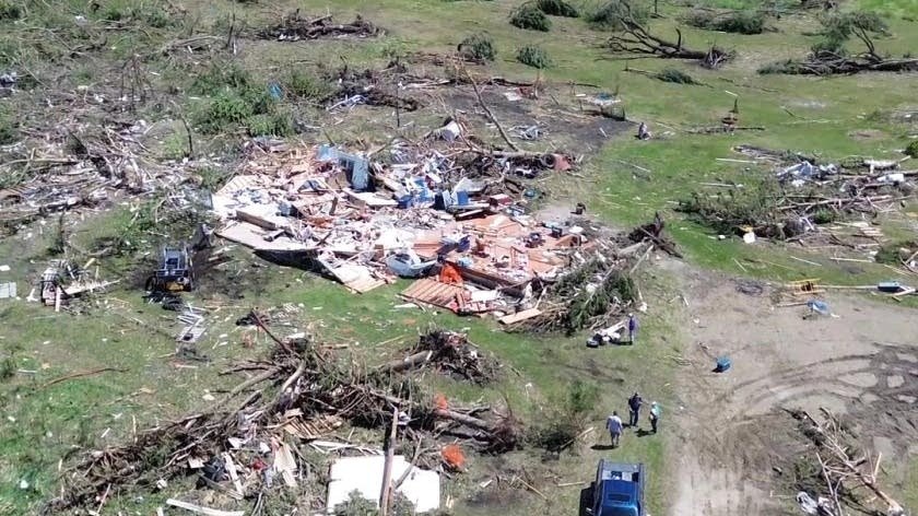
Among the many properties affected was Michelle Thompson and her husband’s farm in the city of Page, N.D., 40 miles south of Enderlin.
The 100 mph winds from the derecho destroyed much of the farm she and her husband own.
"We lost bins, our grain handling systems, you know, just everywhere you look around, and where they used to stand, there was nothing there," Thompson said.
Three months later, she said her community is still rebuilding.
“Yesterday, when I was combining, I could look in the distance and I could see five cranes at different farmsteads,” Thompson said.
The North Dakota Governor’s office estimated that there was $11 million worth of damage to the state.
President Donald Trump has approved the $11 million dollars of funds federal disaster relief aid for North Dakota to use. However, the state won’t be able to tap the aid until the federal government shutdown ends.