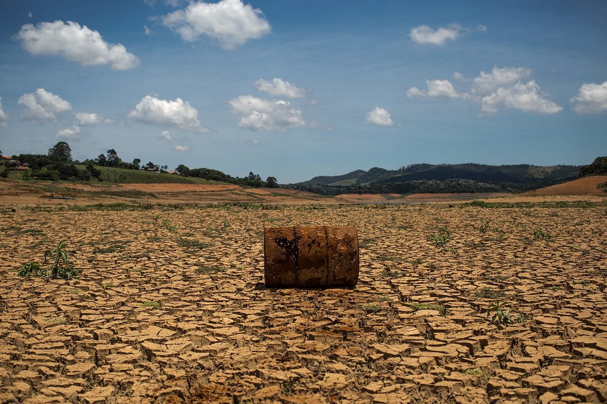
A new dataset spanning from 2000 to 2020 reveals high indices of land transformation and degradation in northeastern Brazil.
The Caatinga – one of Brazil’s six biomes which is composed of semi-arid vegetation – lost 100,000 square kilometers of both forest and grassland, whilst farming grew by 34,000 square kilometers.
Widespread deforestation was also observed near protected areas in the Amazon rainforest, “reinforcing the need for targeted monitoring and conservation.”
The research data, published by the Department of Geography at the University of California, Los Angeles (UCLA), also confirmed the Cerrado, a vast savanna that covers 20% of Brazil, is a “deforestation hotspot.” Agricultural expansion has caused significant damage in the Cerrado, namely in the northeastern states of Maranhão, Tocantins, Piauí, and Bahia.
UCLA experts also warned that confusion between non-native eucalyptus plantations and natural Atlantic forests could result in an overestimation of conservation gains. The Atlantic forest in northeastern Brazil – known for its endemism, or having a large number of species that are unique to the region – has already been degraded by 88% from its original extent.
This research involved the creation of the first land use and land cover dataset specifically designed around northeastern Brazil. Land use and land cover (LULC) maps can provide a more thorough understanding of land utilization, aiding in planning and monitoring environmental programs.
The university’s new LULC map has more specific classifications compared to the current national reference (MapBiomass), which only identifies three types of vegetation in the region, overlooking shrublands – vital indicators in evaluating the Caatinga ecosystem.
Khalil Ganem, a Ph.D. researcher in UCLA’s Department of Geography and a lead researcher on the project, told Latin America Reports that this dataset “increases the level of representation in the Brazilian northeast,” allowing for more accurate analyses of “the magnitude of land coverage changes, as well as identification of the most impacted areas of vegetation.”
According to the recent study the degradation of the Caatinga is currently, although monitored by MapBiomass, still largely underrepresented and often misclassified as Cerrado or grasslands. Ganem explained that whilst this study did shed light on the issue, there is still a long way to go.
Ganem further explained that the issue with classifying the Caatinga lies in that seasonal changes obscure anthropogenic change. During dry seasons, bare soil and degraded shrublands typically have “overlapping spectral responses,” which makes misclassification common.
The researcher emphasized the urgency of the degradation of the Caatinga, which he said is reaching a “tipping point,” and was classified in the latest United Nations Intergovernmental Panel on Climate Change (IPCC) report as a hotspot of climate risk.
“[This research and its] classification of shrublands is vital, as we can now understand how shrublands are being impacted,” noted Ganem.
Policymakers now have a clearer picture, but what is most urgently needed is more investment from local universities in studying this degradation at the local level, according to Ganem.
“There is a need for more local policies, as the north of Brazil is the least protected area in the nation […] Regional research centers should lead studies taking the inconsistencies in our LULC maps and working upon them using high-resolution satellite sets. These [satellites] can work with more specific pixel sizes, increasing the accuracy of classifications between areas.”
Ganem’s next steps involve linking “pixels and people,” building on his research to explore the social dimensions of land use and coverage in northeastern Brazil, and investigating correlations with variables such as mortality and unemployment.
Featured image credit:
Image: Brazil’s northeastern Caatinga semi-arid region
Photographer: Portal Datagro
Source: https://portal.datagro.com/en/12/agribusiness/682167/bndes-and-un-fund-launch-brl-1-billion-bid-for-food-security-in-the-northeastern-semi-arid-region
License: https://creativecommons.org/licenses/by/4.0/